
Walk a Scottsdale Street
A by-address search works best as a linked chain. Start with one valid Scottsdale address and let its stable identifiers lead to the next record. A street name alone can span several blocks, subdivisions, or even jurisdictions. House numbers are not always laid out as a neat series of parcels. The map supplies the spatial order that a text list cannot.
Ownership and occupancy are different facts. The county tax roll names the legal owner and the place where tax mail goes. A deed proves a recorded transfer. A permit may name an owner, builder, or applicant at the time of work. A reverse directory or a lawfully obtained voter extract may offer an occupancy clue, but neither is a complete household list.
- Enter the address in Scottsdale Property Information. Record the owner, APN, lot, quarter section, MCR, and links to maps or permits.
- Open the APN in the Maricopa County Assessor Parcel Search. Compare the property, owner, sale, deed, and mailing fields.
- Place that parcel in the county GIS viewer. Pan along both sides of the block and select each adjacent polygon rather than guessing house numbers.
- Use the deed number or exact owner name in the Maricopa County Recorder search. Match the legal description before joining a deed to the parcel.
- Add city permits, a permitted voter-file request, or a library reverse directory only when that source answers the remaining question.
Search Scottsdale Parcels by Address
The assessor is the strongest first stop for a present-day Scottsdale street search. Its public search accepts several routes into the same roll. An address search finds the taxed site, also called the situs. An owner search is useful when the street spelling fails. APN means assessor parcel number, the county identifier for a piece of land. A subdivision search can expose a group of nearby parcels, which is useful on roads with gaps or irregular numbering.
| Search choice | Input | Useful result | Caution |
|---|---|---|---|
| General search | Parcel, owner, address, or subdivision | Autocomplete route to parcel | Confirm the selected site |
| APN | Dashed parcel number | Direct parcel card | One address may involve more than one parcel |
| Owner Name | Surname, trust, or entity | Matching owner records | Owner is not proof of occupancy |
| Property Address | Full or partial situs | Address-linked parcel | Unit and street type matter |
| Subdivision | Recorded subdivision name | Parcel group | Subdivision and neighborhood are not synonyms |
| Mobile Home | Owner, address, account, or VIN | Mobile-home account | Land and unit records may differ |
The parcel card can show property address, owner, mailing lines, deed number and date, sale details, MCR, subdivision, land size, valuation history, and residential traits. Those fields make the Scottsdale by-address search repeatable. They also show why one name copied from a result is not enough.
The Maricopa County Assessor search screen shows the actual routes available for a Scottsdale address.

The screen is the gateway to the official parcel roll, where a street query can be checked against APN and subdivision data.
Scottsdale Street Address Meanings
A parcel result keeps two address concepts apart. The property address identifies the taxed location. The mailing address tells where the owner wants tax correspondence sent. A match can support an owner-occupancy inference, but it does not prove who is inside the home. A mismatch may reflect a seasonal owner, a trust, an entity, or a simple mailing preference. Scottsdale's seasonal patterns make that distinction especially important.
- Parcel
- A mapped unit of land identified by an APN in the county tax system.
- Situs address
- The physical address assigned to the taxed property, distinct from the owner's mailing address.
- Plat
- A recorded map that divides land into lots, blocks, streets, and easements.
- Criss-cross directory
- A historical directory arranged by street and house number rather than only by a person's surname.
The legal description and APN matter more than a familiar street label when records disagree. Lot, block, subdivision, and MCR references can connect a Scottsdale site across changed postal wording, annexation, or a new address format.
Note: A tax-mail match is one clue, not a public roster of every Scottsdale resident at the address.
Map Scottsdale Streets Parcel by Parcel
The county GIS viewer turns the address search into a map. Enter an address or APN, zoom to the selected polygon, and read its parcel summary. Then pan and click each parcel that touches the target or lies along the opposite side. This is more reliable than typing a run of guessed street numbers. Apartment grounds, corner lots, private drives, washes, and large desert parcels can break a simple numeric pattern.
Underlying county fields may include APN, owner, property and mailing addresses, physical ZIP, deed number and date, sale facts, MCR, subdivision, and land size. Visible layers can add aerial or jurisdiction context, but the assessor parcel page remains the better citation for roll details. A GIS polygon is not certified title.
Map tip. Select one known parcel first, then click nearby polygons in map order to build the Scottsdale street list.
Scottsdale Records Along a Street
Each address-keyed source answers a different question. The Scottsdale by-street record chain becomes useful when the sources stay in their lanes. Parcel and deed records document land. City files document work, review, and some case activity. Library volumes preserve dated name-and-address snapshots. Election data has a separate request process and legal limits.
| Address record | Official keeper | Street clue | Access channel |
|---|---|---|---|
| Tax parcel | Maricopa County Assessor | Legal owner, situs, mailing, value, deed link | Free web search and parcel detail |
| Parcel map | Assessor GIS | Boundaries and adjacent APNs | Free interactive map |
| Recorded instruments | Maricopa County Recorder | Transfer parties and legal description | Online index; office for certified copies |
| Property and permit files | Scottsdale Planning and Development | Lot, QS, MCR, work and case chronology | Online searches; city request fallback |
| Voter file | Maricopa County Recorder | Lawfully released registrants and addresses | Bounded public-record request |
| Reverse directories | Scottsdale Heritage Connection | Listed occupant by street where a reverse section exists | In-building use; rare-item appointment |
When an online tool fails, keep the same identifiers and switch channels. County offices can supply images or certified copies through office procedures. Scottsdale accepts a targeted public-record request for material not posted online. Library staff can confirm whether a requested directory year and reverse section exist before a visit.
Link Scottsdale Streets to Deeds
The Recorder reports a permanent public record beginning in 1871 and more than 52 million searchable documents. That span gives Scottsdale address work a deep land-record backbone, including the era before Scottsdale incorporated. Deeds, deeds of trust, releases, liens, plats, surveys, easements, and judgments may carry party names or land descriptions.
Start with the deed number from the assessor card. If that route fails, search the current owner as grantee, which means the receiving party, near the sale date. Open the purchase deed and compare its lot, block, subdivision, MCR, or other legal text with the parcel. The recorded image may show grantor, grantee, a return address, notarization, and recording stamp. An image is not a certified copy, and a deed never proves the named owner lived there.
The Recorder's web index can be searched by name, recording number, date range, document code, book and page, or legal-description clues. Trust names, initials, spelling forms, and entity names should be tried separately. For an official copy or a record missing from the web display, use the Recorder's copy channel or an in-person county terminal.
Note: Scottsdale incorporated in 1951, so early address research depends on county land records, plats, census material, and metropolitan sources.
Search Scottsdale Permits by Street
City records can date what happened at a parcel. The Scottsdale Building Permit Search accepts permit number, street number, street name, subdivision, lot, owner or builder name, APN, and unit. A single field is often enough. The separate planning document search breaks an address into street number, street name, type, and unit, then adds case, plan check, permit, lot, parcel, full-text, and document-type choices.
Results may lead to certificates of occupancy, elevation certificates, site plans, planning cases, or permit chronology. They can name an applicant, owner, designer, or builder at a point in time. None is a current resident roll. Building plans also have a sharp local limit: Scottsdale destroys them 180 days after completion or expiration, and the plans remain the architect's or engineer's intellectual property. Permit facts, retained certificates, site plans, quarter-section maps, and the named designer may become the fallback.
The city permit interface shows how Scottsdale street and parcel fields can narrow a search.
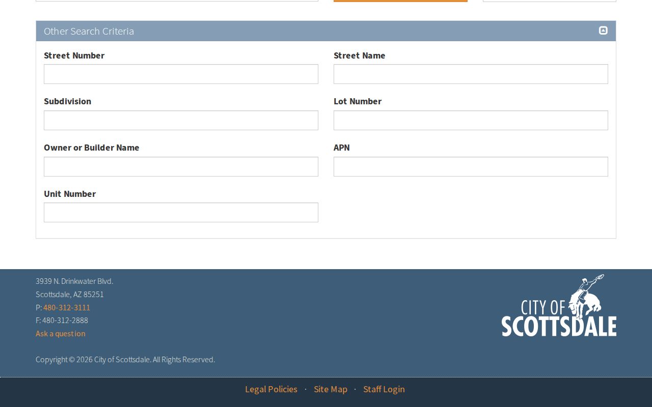
Its mix of address, APN, subdivision, and owner or builder fields helps reconnect a permit with the correct parcel.
Scottsdale Planning Records by Address
The Scottsdale Planning and Development records page sets out the city access routes for property, permit, plan, case, and GIS material.
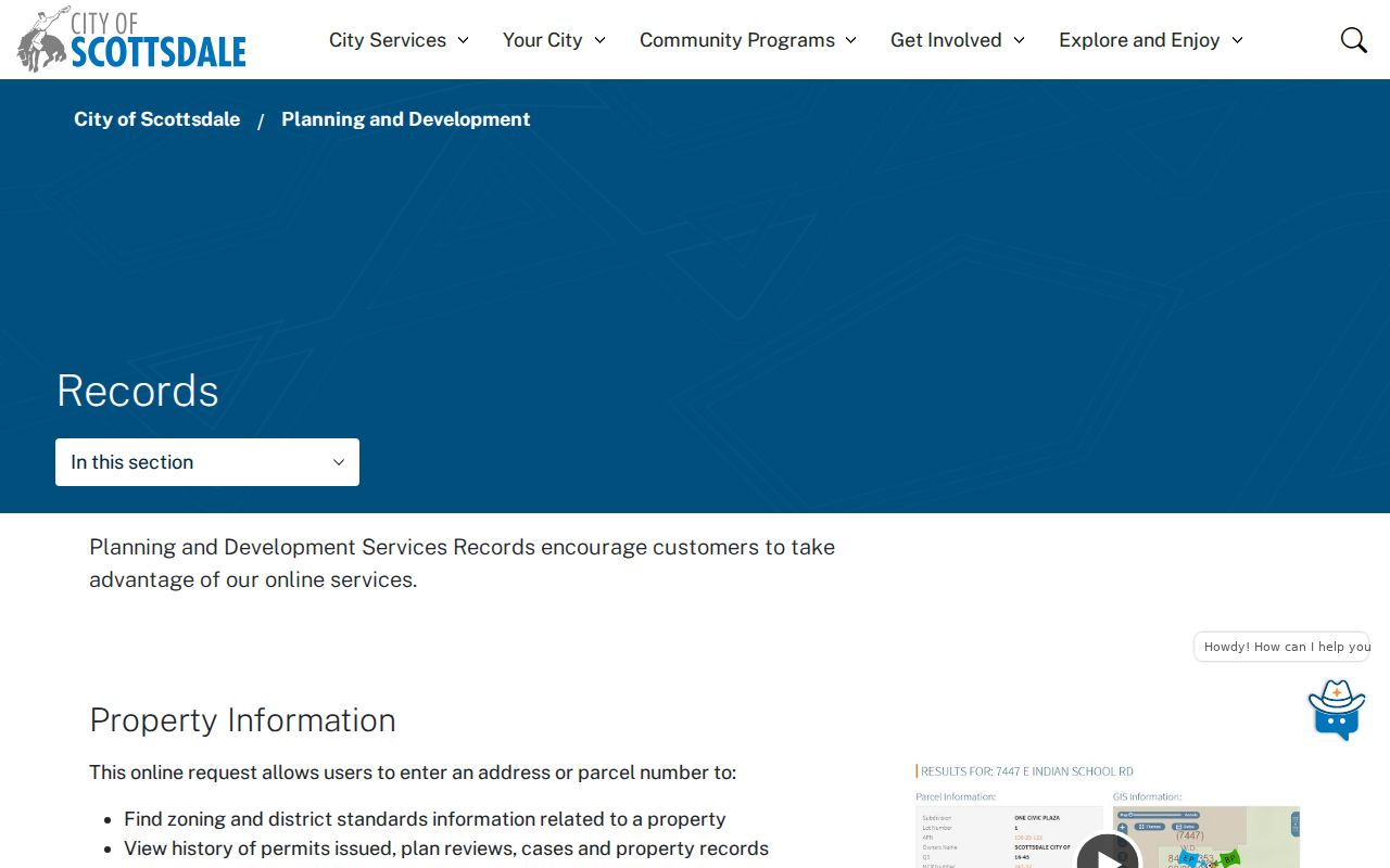
That city gateway helps a street researcher choose self-service search, staff contact, or a narrow records request without confusing a plan file with an occupant list.
The Scottsdale planning document search exposes the separate address, parcel, permit, case, and document-type fields.
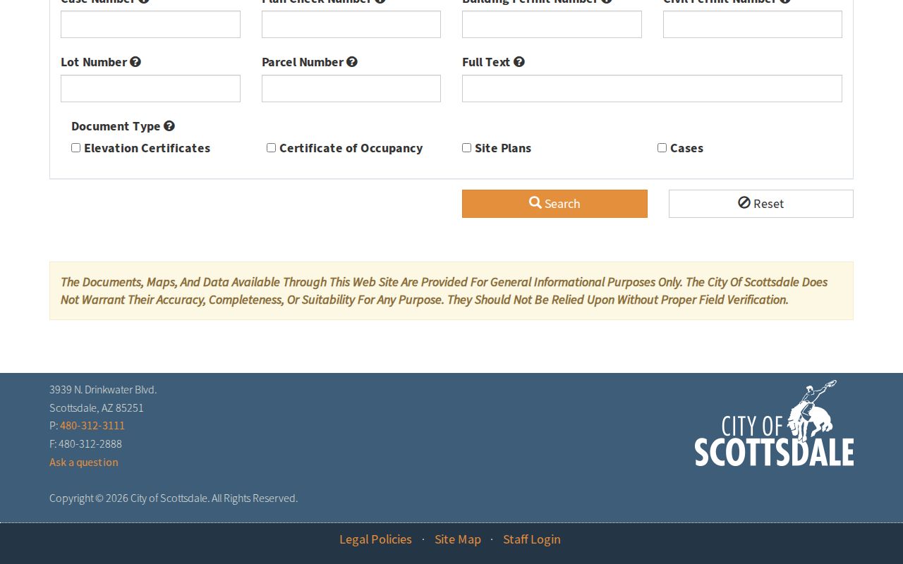
The screen shows why a partial street name or an APN can succeed when a full postal address was entered in a form the system does not expect.
Scottsdale Street Voter Limits
My.Arizona.Vote is an identity-gated check for one's own registration and election information. It is not a browseable Scottsdale by-street roll. The usual path requires identifying inputs such as legal name, date of birth, and county or residence data. A failed match can follow a recent move, a name variation, federal-only status, cancellation, or protected registration.
Street-level voter information uses a different channel. A Maricopa County public-record request can seek VM51 data bounded by county, precinct, or political district and by registration status. Released fields can include name, registration date, addresses, party, phone, status, and participation history. Ballot choices are never public. Protected voters are omitted under A.R.S. § 16-153, and use of voter information is governed by A.R.S. § 16-168. Electronic files are fulfilled through secure download.
Scottsdale Street Geography Tests
A Scottsdale mailing line does not settle city jurisdiction. The 85254 postal area is the best-known caution: much of it is governed by Phoenix despite the Scottsdale mailing identity. Northern postal Scottsdale can also reach county or unincorporated land. Before sending a request to a city department, verify the parcel in county GIS and check the relevant municipal boundary.
Scottsdale sits east of the Phoenix central baseline, which explains the common “E” in local addresses. Local forms split street number, street name, type, and unit. Those parts help normalize a query, yet the APN, MCR, lot, and legal description remain stronger bridges when a postal phrase changes. Annexation can change jurisdiction without changing the USPS city line.
Old Town and south Scottsdale often reward early plats and postwar sources. McCormick Ranch and Gainey-area research leans more on subdivision MCRs and parcel files. Airpark searches must separate business sites from homes, while far-north desert parcels demand close boundary review.
Scottsdale Streets in Old Directories
The Scottsdale Heritage Connection holds residential and business directories, yearbooks, maps, newspapers, microforms, and local files at Civic Center Library. Some volumes may include a reverse section arranged by street and house number. Exact directory years and publishers are not posted as a complete official web inventory, so request the volume and verify its arrangement before relying on it.
A reverse entry is a dated occupancy clue, not a continuous roll. It can omit people who declined listing, new arrivals, boarders, or households outside that edition's scope. For a full account of the collection, consult the Scottsdale directory book page. The street search should only use the needed volume, then return to parcel and legal-description evidence for continuity.
Limits of Scottsdale Street Records
No official Scottsdale by-address roll names every person at a home. Parcel records leave out nonowners. Deed records prove transfers, not residence. Permit applicants may be firms or tradespeople. Voter files exclude those who are not registered and omit protected voters. Historical directories are snapshots. Utility customer and motor-vehicle address details are not open household lists.
Use the narrowest source that answers a lawful personal question. Check an official record at its keeper, preserve the date viewed, and avoid publishing a compiled list of people from a block. Arizona's Address Confidentiality Program gives qualifying survivors a substitute address, mail forwarding, and protected voter registration. A missing name can therefore reflect a sound protection, not a bad search.
Lawful use. Scottsdale address records may support genealogy, parcel research, and civic inquiry. Never use them to stalk, harass, intimidate, or expose a protected person.